
|
 |
May 27, 2008
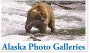
The Alaska Highway guide"Grizzly bears, black bears, wolves, falcons, ptarmigan, grouse, hare, owls, eagles, and hare, to mention a few."The Alaska Highway (also called the ALCAN Highway) is a long 1,390 mile (2,237 km) road stretching from Delta Junction, Alaska at its northwestern end to Dawson Creek, British Columbia, Canada at its southeastern end. 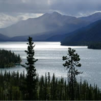
At the time of it's completion in 1943, during World War II, the ALCAN was a gravel road. However, the Alaska portion of it was paved in the 1960's, and the Canadian portion, in the 1980's. The highway is plowed in the winter by both the Canadian and the Alaskan governments, so it is in good condition and driveable year-round. However, be prepared for minus 40-degree temperatures in the winter. Some vehicles (especially older cars) have trouble starting in such cold weather. There is a 40-mile section of road along Kluane Lake in Canada that seems to be perpetually under construction in the summer, so expect to be slowed down along that segment of the route. It is also important to note that many of the businesses (including gas stations and motels) along the highway close for the winter. So if you're planning on stopping at motels on the way, call before your trip to verify that they will be open. In the summer, there's usually some kind of a business every 100 miles or so. In Alaska, the distances and signs are posted in miles and miles per hour. However, Canada uses the metric system, so signs will be in kilometers (km) per hour. One mile = 1.6 kilometers. Also, gas in Alaska is measured in gallons, and in Canada, in liters. One gallon = 3.79 liters. In general, you should expect to pay around 15 - 20% more for gas along the ALCAN. American debit and credit cards are accepted everywhere along both the Canadian and the Alaskan portions of the highway, so you needn't worry about exchanging currency. Probably the most memorable features of the ALCAN highway are the spectacular vast, primal scenery and the amazing array of wildlife, including grizzly bears, black bears, wolves, falcons, ptarmigan, grouse, hare, owls, eagles, and hare, to mention a few. History of the HighwayThe road was originally built mostly by the US Army as a supply route during World War II. There were four main thrusts in building the route: southeast from Delta Junction, Alaska toward a linkup at Beaver Creek, Yukon; north then west from Dawson Creek (an advance group started from Fort Nelson, British Columbia after traveling on winter roads on frozen marshland from railway stations on the Northern Alberta Railways); both east and west from Whitehorse after being ferried in via the White Pass and Yukon Route railway. The U.S. Army commandeered equipment of all kinds, including local riverboats, railway locomotives, and housing originally meant for use in southern California. Although it was completed on October 28, 1942 and its completion was celebrated at Soldier's Summit on November 21 (and broadcast by radio, the exact outdoor temperature censored due to wartime concerns), the "highway" was not usable by general vehicles until 1943. Even then, there were many steep grades, a poor surface, switchbacks to gain and descend hills, and few or no guardrails. Bridges, which progressed during 1942 from pontoon bridges to temporary log bridges, were replaced with steel bridges where necessary only. One old log bridge can still be seen at the Aishihik river crossing. The easing of the Japanese invasion threat resulted in no more contracts being given to private contractors for upgrading of specific sections. In particular, some 100 miles of route between Burwash Landing and Koidern, Yukon, became virtually impassable in May and June of 1943, as the permafrost melted, no longer protected by a layer of delicate vegetation. A corduroy road was built to restore the route, and corduroy still underlays old sections of highway in the area. Modern construction methods do not allow the permafrost to melt, either by building a gravel berm on top or replacing the vegetation and soil immediately with gravel. However, the Burwash-Koidern section is still a problem, as the new highway built there in the late 1990s continues to experience frost heave. © AlaskaReport - All Rights Reserved. |
|